Low stock: 1 left
Original Antique Map c.1925 - India, North-West with Baluchistan
Original Antique Map c.1925 - India, North-West with Baluchistan
Couldn't load pickup availability
Synopsis
Synopsis
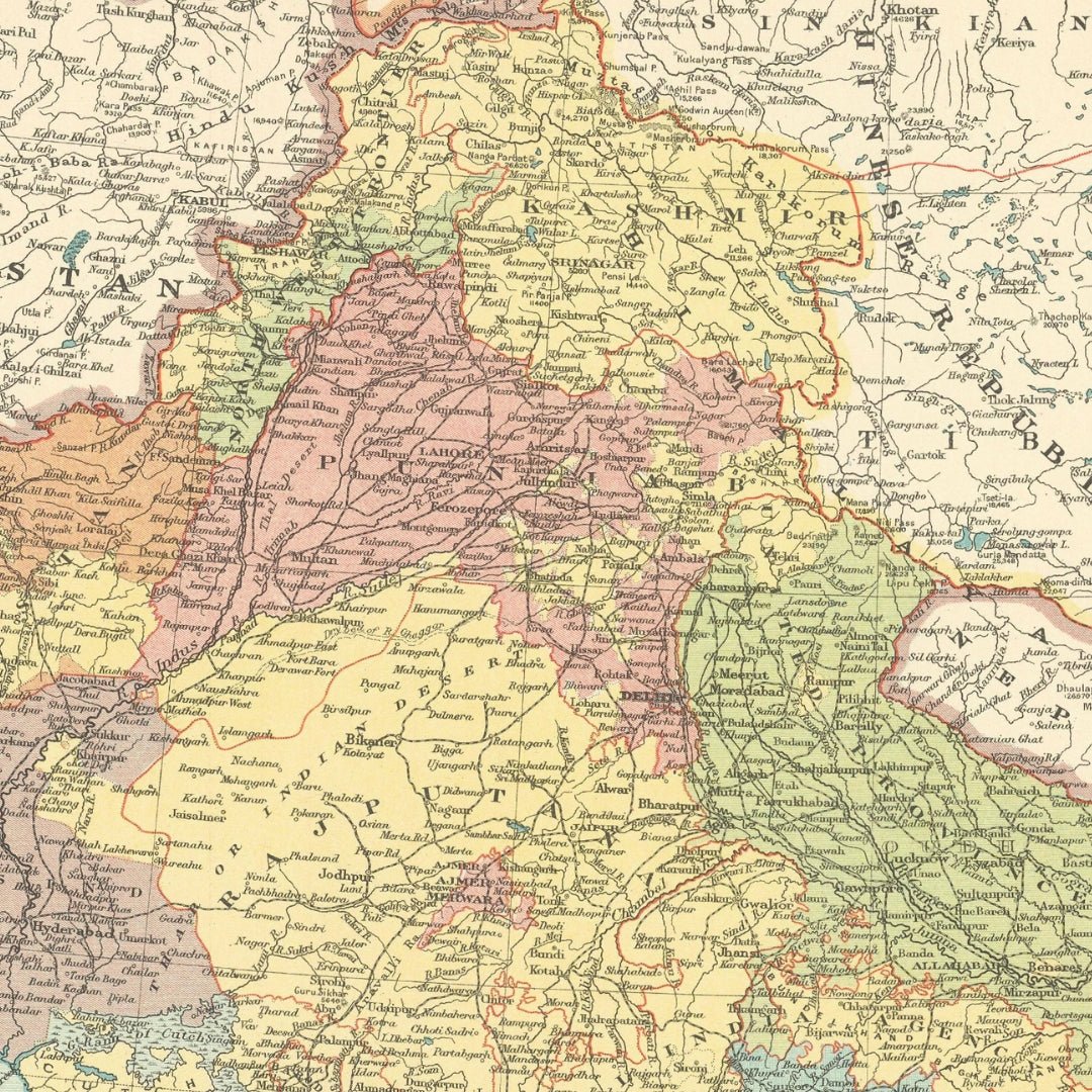
We have an original antique map titled “India, North-West with Baluchistan,” estimated to have been published around 1924 or 1925.
The map size is approximately 36.0 x 28.5 cm (14 x 11.25 inches), making it a large atlas map, suitable for framing. This map highlights the North-West region of British India, including areas that are now part of Pakistan and Afghanistan. The condition is good, though typical signs of aging are present but generally unobtrusive. Please review the scan carefully for any blemishes before purchasing. We offer a no-questions-asked return policy.
This is an authentic historic map from the mid-1920s, not a modern reproduction. The reverse side is plain with nothing printed on it.
The map was created by Edward Stanford Ltd. and originally appeared in “Stanford’s London Atlas of Universal Geography, ‘Whitehall’ Edition,” published by Edward Stanford Ltd., London.
Your purchase will be securely packaged for safe delivery.
Colour
Colour
Multicolor
Country
Country
India, Myanmar (Burma), Pakistan, Bangladesh, and Nepal