Out of stock
Original Antique Map 1912 - Northern British India: Battlefields and Dates
Original Antique Map 1912 - Northern British India: Battlefields and Dates
Couldn't load pickup availability
Synopsis
Synopsis
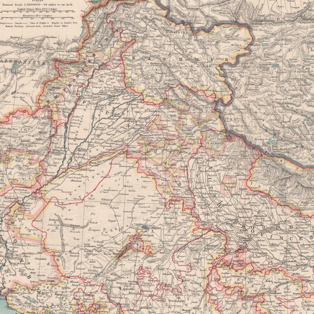
We have an original antique map titled “India (Northern Sheet),” dated 1912.
The map size is approximately 34.5 x 45.0 cm (13.75 x 17.75 inches), making it a large folding map, suitable for framing. This map highlights the northern region of British India, including Nepal and Tibet, and marks significant battlefields with their corresponding dates. The condition is good, with typical signs of aging that are generally unobtrusive. Please review the scan carefully for any blemishes before making your purchase. We offer a no-questions-asked return policy.
This is an authentic historic map from 1912, not a modern reproduction. The reverse side is plain with nothing printed on it.
The map was created by W. & A.K. Johnston, Limited, Edinburgh & London, and originally appeared in “The Handy Royal Atlas of Modern Geography,” by Alexander Keith Johnston, with additions and corrections by G.H. Johnston, published by W. & A.K. Johnston, Limited, London.
Your purchase will be securely packaged for safe delivery.
Colour
Colour
Multicolor
Country
Country
India, Myanmar (Burma), Pakistan, Bangladesh, and Nepal