Low stock: 1 left
Original Antique Map 1886 - Indes Orientales (East Indies)
Original Antique Map 1886 - Indes Orientales (East Indies)
Couldn't load pickup availability
Synopsis
Synopsis
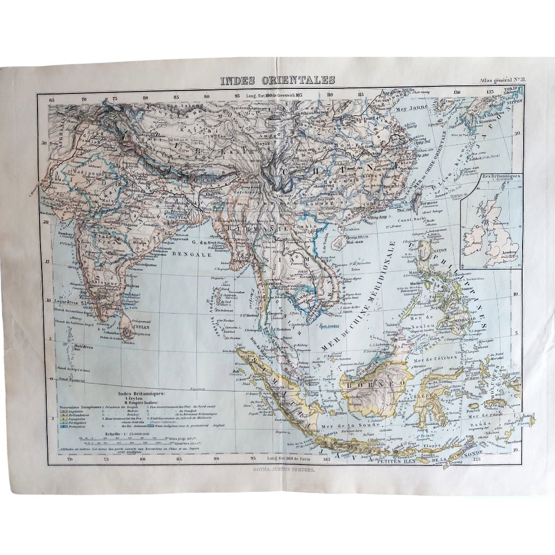
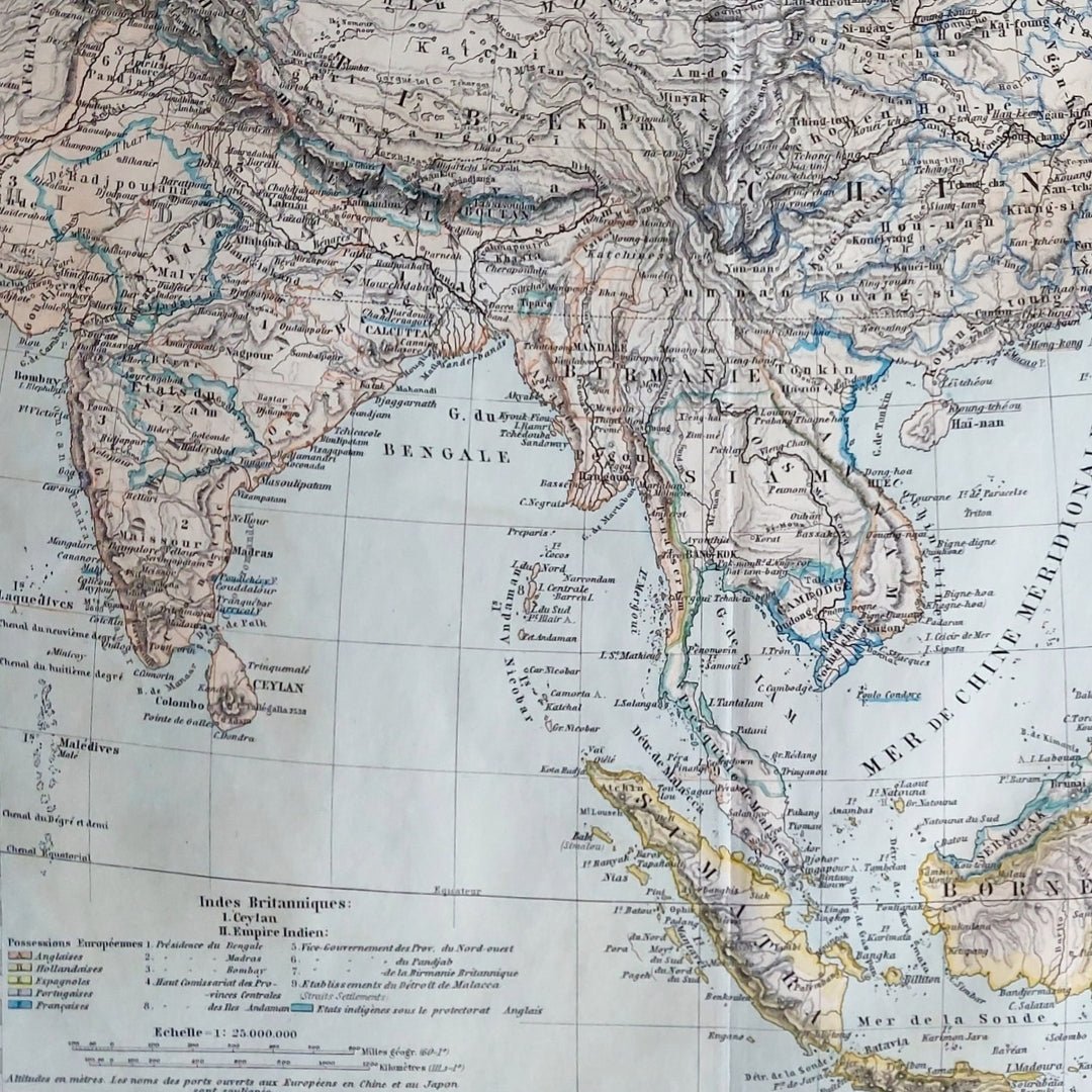
We have an original antique map titled “Indes Orientales,” published in 1886.
This attractive small double-page map covers India, Indo-China, the East Indies, and surrounding regions. It comes from the Atlas-General published by Justus Perthes, Gotha. The map offers a detailed and beautifully rendered view of the East Indies during the late 19th century, reflecting the geographical knowledge of that era.
The map is an authentic historic piece from 1886, not a modern reproduction. Its origin in a well-regarded atlas enhances its value as both a decorative and educational artifact.
Your purchase will be securely packaged for safe delivery.
Colour
Colour
Multicolor
Country
Country
India, Myanmar (Burma), Pakistan, Bangladesh, and Nepal