Out of stock
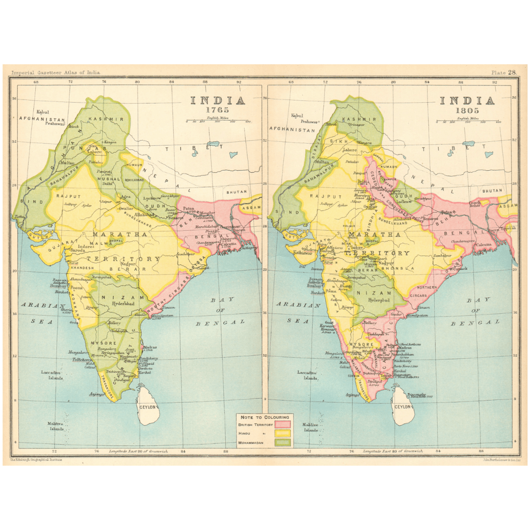
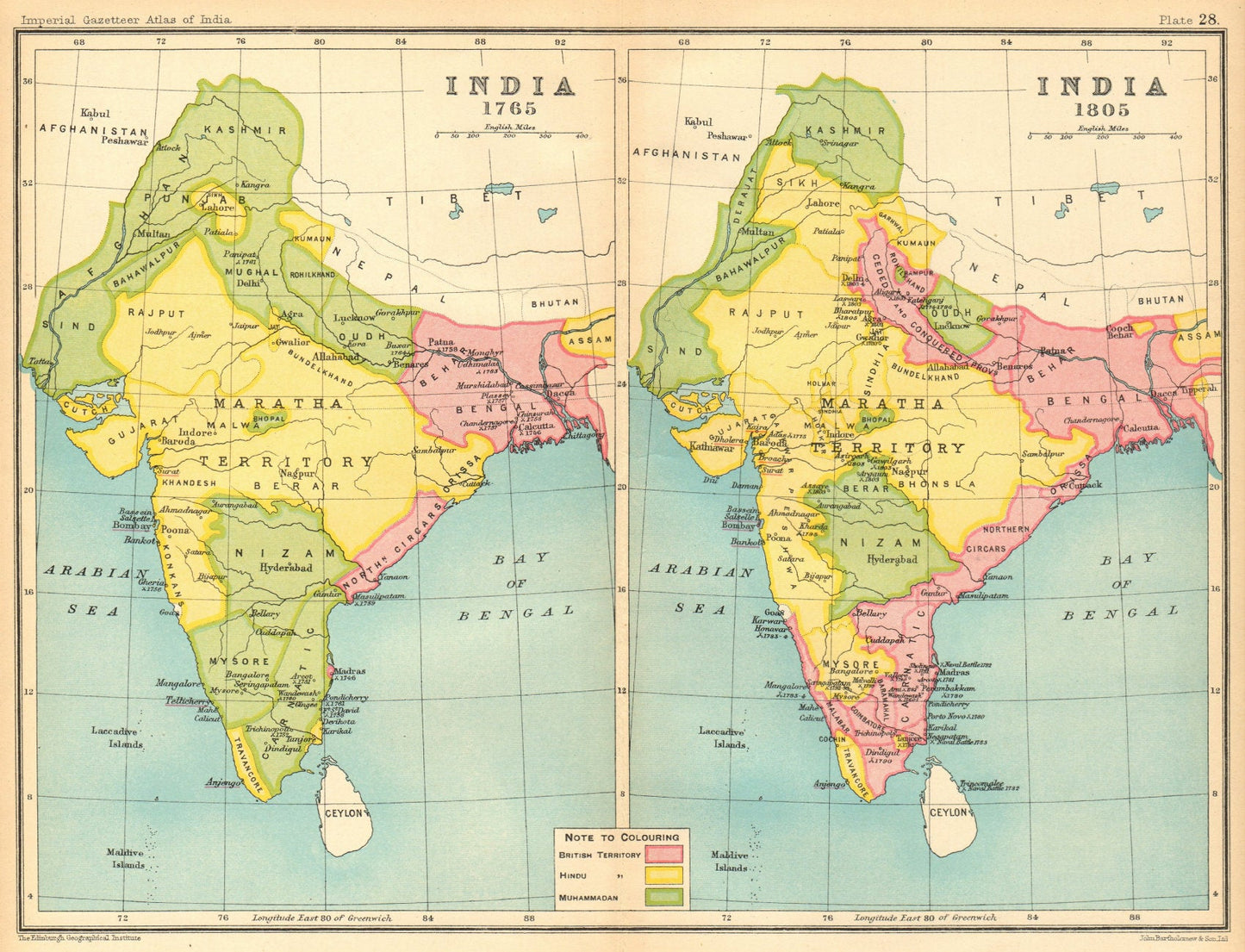
Historical India (1765 & 1805): British, Hindu, Sikh & Muslim States – 1909 Vintage Map
Historical India (1765 & 1805): British, Hindu, Sikh & Muslim States – 1909 Vintage Map
Couldn't load pickup availability
Synopsis
Synopsis
Date Printed: 1909
Image Size: Approximately 20.5 x 26.0 cm (8 x 10.25 inches) – Medium. Please note: This is a folding map.
Artist/Cartographer/Engraver: J. G. Bartholomew
Provenance: Extracted from The Imperial Gazetteer of India, New Edition, published under the authority of His Majesty’s Secretary of State for India in Council, Oxford, Clarendon Press.
Type: Antique color gazetteer map
Verso: Blank (no printing on the reverse side)
Condition: Good; suitable for framing. Please note: The displayed image may be from a different copy of the same map. Normal aging is expected in antique maps and prints.
Authenticity: This is an original, historic print published in 1909—not a modern reproduction. The term original refers to its first date of publication, not uniqueness. A print refers to any image created using traditional printing techniques such as wood engraving, steel engraving, copperplate, woodcut, or lithography.
Colour
Colour
Multicolor
Country
Country
India, Myanmar (Burma), Pakistan, Bangladesh, and Nepal